
| These
pages offer a (very) brief written description of the Lakeland hills, but
this is first and foremost just a set of photographs, just click on the
"cameras" ( The title of this page is intended as a homage to Wainwright's guides and I shamelessly plug them below as I believe they are, and will remain, the ultimate guides to these hills. The
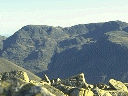
Northern Fells, Skiddaw and Blencathra Borrowdale
and Derwentwater
|
 |
Wainwright's
Pictorial guides to the Lakeland Fells. first published by Westmoreland
Gazette. A.Wainwright 12x16cm
bw
Famous
hand drawn and written exhaustive guide to the Lake District in seven volumes
plus an additional volume for minor fells (hardback, pocket size).
In
my years of hillwalking I have used and bought many guides to the other
British hills but my set of Wainwrights has been my only Lake district
guide for 25 years.
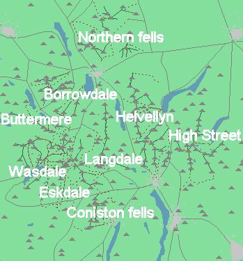
Areas
covered by guides:-
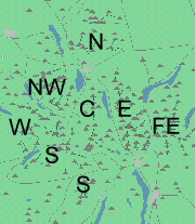
FE
High Street,E
Helvellyn, C north
from Langdales, S
south of Wasdale inc. Scafell Pike and Coniston fells, NW
Grasmore, W north
of Wasdale, inc Pillar.N
Skiddaw, Blencathra and "back o' Skiddaw"
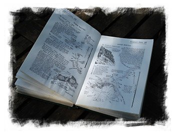
(Image
on right is a reproduction of part of the 30th page of the Scafell Pike
section). Each guide contains a written description, hand drawn maps, topographical
diagrams of each route of ascent, sketches and often panoramas of the summit
view, for all the hills in the area, along with available ridge routes
to adjacent hills. Difficult areas such as Lords Rake
(below) are detailed in sketches and extra diagrams. There are a number
of other Wainwright titles, some in the Wainwright style and some collaborations
with photographs, one that deserves mention is the "Coast
to Coast".
The
second edition
Chris
Jesty has updated information such as car parks and paths actually in use
on the ground are shown in red, text changes are achieved by use of a "Wainwright"
font.
Buy the Pictorial
Guides to the Lakeland Fells from Amazon.co.uk
"Second
edition" refers to Chris Justy edited, "first edition" to the original
book in whatever earlier edition it is being sold as. The 50th Anniversary
has a frontispiece with a photo of "AW".
Eastern (second
edition)![]()
Eastern (50th
anniversary edition)![]()
Eastern
(first edition, second hand)![]()
Far
Eastern(second edition)![]()
Far Eastern
(50th anniversary edition)![]()
Far
Eastern(first edition, second hand)![]()
Central
(second edition)![]()
Central (50th
anniversary edition)![]()
Central
(first edition)![]()
Southern
(second edition)![]()
Southern
(50th anniversary edition)![]()
Southern
(first edition)![]()
Northern![]()
Northern
(50th anniversary edition)![]()
N.Western ![]()
N.Western
(50th anniversary edition)![]()
Western![]()
Western (50th
anniversary edition)![]()
Outlying ![]()
 Special
edition boxed set
Special
edition boxed set
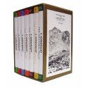
All
seven ("outlying" not included) Wainwright guides.
The
ultimate guide to the Lakeland Fells that
is
unlikely to be bettered.
50th
Anniversary edition (above)![]() Standard
edition boxed set
Standard
edition boxed set![]()
I
believe the Wainwright books will remain timeless, but if you feel the
need for GPS support, have a look at Discovery
guides