
More pictures


Thames
path books and boating
![]() Guide
books and maps
Guide
books and maps
![]() Boating
on the River Thames
Boating
on the River Thames
![]() General
books
General
books
Thames
path pubs and London
![]() River
side pubs, Barrier to Windsor
River
side pubs, Barrier to Windsor
![]() London
- north or south bank?
London
- north or south bank?
![]() River
side pubs - Windsor to Source
River
side pubs - Windsor to Source
![]() A
weeks walking itinerary - Windsor to the source
A
weeks walking itinerary - Windsor to the source
Thames
path photos
![]() Photos
(thumbnails) Barrier to Houses of Parliament
Photos
(thumbnails) Barrier to Houses of Parliament
![]() Photos
(thumbnails) Lambeth to the source
Photos
(thumbnails) Lambeth to the source
![]() Photos
(thumbnails) Regents canal
Photos
(thumbnails) Regents canal
![]() Photos
(thumbnails) Lee Navigation
Photos
(thumbnails) Lee Navigation
 Photos
(thumbnails) Kennet and Avon canal
Photos
(thumbnails) Kennet and Avon canal
Photos
Oxford Canal
![]() Photographs
by area, select sets to view
Photographs
by area, select sets to view
![]() Photographs
by content
Photographs
by content
![]() Favourite
photos
Favourite
photos
The
Thames Path
Walking
and
stopping
overnight
at
Thame's side inns is one of the best ways to
enjoy the Thames, we try to do it as often as possible along the Thames
path.
Difficulty
The
Thames
path
is
an
easy route both in terms of ground and route finding.
Finding camping sites would be difficult along parts of the route. 180
miles (290k) 12-14 days. (Windsor to source fits into a week). Minimal
ascent, 5m to 110m in 180 miles, with a few minor ups and down along
the
way.
Security
London
is
a
big
city
and like all big cities the usual precautions should be
taken
with wallets etc. I would suggest doing the first section from the
barrier
(and the extension - which around Erith has the additional issues of
isolation from view, lack of escape routes and proximity to a
population centre  ) early
in the day and in company, taking particular
care in the stretch
just upstream of the "Cutty Sark". I don't want to give the impression
these places are dangerous, but I feel I should warn the unwary who may
not be as streetwise as the average city dweller. (I did the former
section
after dark and am still here to tell the tale!)
) early
in the day and in company, taking particular
care in the stretch
just upstream of the "Cutty Sark". I don't want to give the impression
these places are dangerous, but I feel I should warn the unwary who may
not be as streetwise as the average city dweller. (I did the former
section
after dark and am still here to tell the tale!)
Football
and other crowd pulling events
On
the
London
sections
you
might like to check if Charlton,
Millwall,
Chelsea, Fulham or Queens Park Rangers are playing at home near a
pub
you aim to use at lunchtime (or an area you wish to park in). One
walker
reports he could only get a cheese roll in the "Anchor and Hope" on a
Charlton
match day.Note the Fulham ground is on the riverfront and the path goes
round it (there is an alternative path on the south bank).Henley
regatta,
the Oxford and Cambridge boat race and the Reading Jazz
festival<website>
are other events to note. London from Greenwich to The Houses of
Parliament
would be almost impossible on London Marathon day (a Sunday in
April).
Thames
events
| Henley regatta <website> <womens' event> | End of June into July. Womens' mid June. |
| Reading regatta <website> | Mid June |
| Swan Upping <website> | Third week of July on upper Thames[1] |
| The Great River Race <website> | Richmond to Greenwich in September |
| Head of the river race <website> womens' race <website> | Mortlake to Putney in March |
| University boat race <website> | March, Putney Bridge to Chiswick Bridge. |
| Doggett Coat and Badge race and Port of London Challenge Race | London Bridge to Chelsea, two dates in mid July |
| Marlow Regatta <website> | June |
1]
Swan upping
Every year in the
third
week of July, The Queen's Swan Marker and the swan uppers from the
Vinters'
and Dyers' Livery companies, travel the Thames from Sunbury on Thames
to
Abingdon in their scarlet uniforms and in traditional Thames rowing
skiffs.
marking and inspecting mute swans.
Who it
would suit
Anyone
who
would
enjoy
walking
through a cross section of southern England. It
would not suit anyone looking for a challenging wilderness experience.
An ideal first long distance path or succession of day/weekend walks.
(good
railway services for all of the route) But don't take bites at it at
random,
part of the beauty of the walk is in experiencing the progression of
human
activities up the river.
Cost and
accommodation
The
majority
of
the
riverfront
buildings along the river are now considered
some of the most desirable in the country and therefore the most
expensive.
Inevitably this is reflected in the price of accommodation and
restaurant
meals, especially in central London and the more desirable locations
upstream.
Small "B&Bs" just away from the river will of course be cheaper
than
riverfront pub/hotels. The Ramblers Association list "B&B"s, just
click
the accommodation button on their
page (after bookmarking this one!).
One
novel
solution
is
a
boat
that provides overnight accomodation and carries your luggage!
Distances
| Starting from | Distance
to
next
point North bank |
Distance
to
next
point South Bank |
| Thames Barrier | 4 | 4 |
| Greenwich | 6 | 4.5 |
| Tower Bridge | 0.5 | 0.5 |
| London Bridge | 2.5 | 2 |
| Westminster | 1.5 | 1 |
| Vauxhall | 6 | 7 |
| Putney | 2 | 1.75 |
| Hammersmith Broadway | 2.5 | 2 |
| Barnes Bridge | 3 | 2.5 |
| Kew Bridge | 4 | 3 |
| Richmond | 3.5 | 2.75 |
| Teddington | 5 | 5 |
| Kingston Bridge | 2 | No further choice of bank |
| Hampton Court | 3 | |
| Shepperton | 6 | |
| Staines | 6 | |
| Datchet | 2 | |
| Windsor | 1.75 | |
| Maidenhead | 6.5 | |
| Cookham | 3.25 | |
| Bourne End station | 3.25 | |
| Marlow | 3.25 | |
| Hurley | 2.5 | |
| Hambledon Lock | 3.75 | |
| Henley | 2.5 | |
| Shiplake | 2.25 | |
| Sonning | 3.25 | |
| Reading | 3.5 | |
| Tilehurst | 3.5 | |
| Pangebourne | 4.25 | |
| Goring | 4 | |
| Cholsey | 3.75 | |
| Wallingford | 5.5 | |
| Day's Lock (Dorchester) | 5.25 | |
| Culham | 2.75 | |
| Abingdon | 3.25 | |
| Lower Radley | 6 | |
| Oxford | 6.25 | |
| Swinford | 7.75 | |
| Newbridge | 6 | |
| Tadpole Bridge | 4 | |
| Radcot Bridge | 6.25 | |
| Lechlade | 2.25 | |
| Upper Inglesham | 4.25 | |
| Castle Eaton | 4.25 | |
| Cricklade | 5.5 | |
| Ashton Keynes | 7 | |
| Source | - |
Download Thame's milages as Excel spreadsheet
(If
you
have
problems
downloading
try
holding down shiftkey while clicking on link
or
right click the link and choose "save to...")
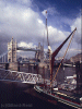
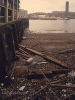
The Extension
The best way to tackle the extension is from Slade Green
station. Take Moat Lane on the north side of the station (left of the
exit) and reach The Darent at Crayford Marshes, then follow the river.
This section has good numbers of waders and ducks in winter,
diminishing in numbers as the path approaches London proper. After the
Erith rejuvenated waterfront the path passes along the river isolated
and hidden from view, see security. After the
historic Crossness pumping engines the riverfront is lined with the new
flats that are a feature of much of London's Thames nowadays. If doing
this section separately, it can be finished at Charlton station. There
are no riverfront pubs on this section.
Thames Path
proper - Industrial
beginings
The
path
starts
amoungst
a
jumble of industry, not pretty, but not without
interest and those whose first reaction is to think of skipping the
start
of the walk should first reflect that the fascination of the walk lies
in the rivers progress through all the uses man has put the river to.
In
any case, as the years pass plants discharging dubious effluents
are being replaced by affluent housing developments. However if only a
single week is available and/or you would need to pay for London
accomodation, starting
from Windsor gives good, mainly rural, walking.
This
early
stage
gives
fine
views of that monument to political megolomania, (now
finally put to sensible uses)
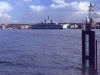
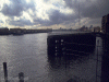
the millenium dome![]() .
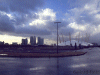
Canary Wharf looms in the distance and of course the barrier
.
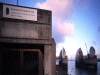
Canary Wharf looms in the distance and of course the barrier![]() ,
where the walk starts[1] (note that
early starters will have to miss the first few yards of path through
the
locked visitor centre). Note that the path round the dome may divert
away
from the river edge due to the various development works in progress.
(In
Feb 2005 I was diverted away from river for a couple of hundred yards
to
near the entrance to the northbound Blackwall tunnel to get round
works,
when away from the river in this area it can be less than scenic!).
,
where the walk starts[1] (note that
early starters will have to miss the first few yards of path through
the
locked visitor centre). Note that the path round the dome may divert
away
from the river edge due to the various development works in progress.
(In
Feb 2005 I was diverted away from river for a couple of hundred yards
to
near the entrance to the northbound Blackwall tunnel to get round
works,
when away from the river in this area it can be less than scenic!).
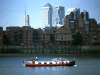
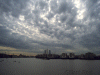
City
& South
Bank
Soon
industry
is
left
behind
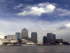
and the north bank is lined with the overpriced
flats of the overpaid city market traders and thier towering offices at
Canary
Wharf![]() ,
originally planed as a low rise development! Some interesting parts of
the old east end remain including "The Prospect
of Whitby"
,
originally planed as a low rise development! Some interesting parts of
the old east end remain including "The Prospect
of Whitby"![]() and "The Mayflower"
and "The Mayflower" ![]() where
the ship of that name (also built in Whitby) was reputedly berthed,
fitted
and crewed before its historic voyage from Plymouth to America,
although
the pub has only had that name since 1960, formerly being the "Spread
Eagle"
which was largely destroyed by a V1 rocket in WW2.
where
the ship of that name (also built in Whitby) was reputedly berthed,
fitted
and crewed before its historic voyage from Plymouth to America,
although
the pub has only had that name since 1960, formerly being the "Spread
Eagle"
which was largely destroyed by a V1 rocket in WW2.
The
south
bank
is
graced
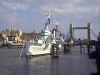
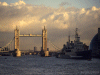
with two interesting ships "The
Cutty
Sark" *![]() and
"Gypsy Moth IV"
and
"Gypsy Moth IV"![]() (currently (2005) being refitted for another voyage) alongside The Royal
Nautical College
(currently (2005) being refitted for another voyage) alongside The Royal
Nautical College![]() ,
National Maritime Museum and above and behind the Royal
Observatory
,
National Maritime Museum and above and behind the Royal
Observatory![]() on
the Greenwich meridian. Further on, the reconstructed Globe
theatre
on
the Greenwich meridian. Further on, the reconstructed Globe
theatre![]() makes a strong contrast to the brutalist concrete of the South
Bank complex
makes a strong contrast to the brutalist concrete of the South
Bank complex![]() .
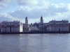
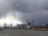
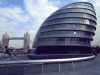
The Millenium Eye is everything the dome
failed
to be, next to County Hall and the Houses of
Parliament
.
The Millenium Eye is everything the dome
failed
to be, next to County Hall and the Houses of
Parliament![]() and its clock tower containing "Big Ben"
and its clock tower containing "Big Ben" ![]() across
the river.
across
the river.
* The Cutty Sark is currently under restoration (2007) and after a major fire in need of funds. <website>
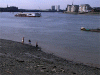
Suburban
London
After
Chelsea
and
Battersea
Park
with the London
Peace
Pagoda![]() we
move towards the
we
move towards the
comfortable
if
a
little
dull
suburbs at Putney![]() ,
Hammersmith, Kew and Richmond with its deer park edging the south bank
and Richmond with the first lock, although the river is tidal to Teddington
,
Hammersmith, Kew and Richmond with its deer park edging the south bank
and Richmond with the first lock, although the river is tidal to Teddington![]() .
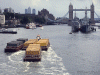
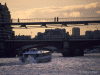
Serious rowing
.
Serious rowing![]() is now the order and will remain so for many miles. Eel Pie island was
originally a day trip destination for Victorians, later a haunt of
beatniks
and then blues/rock groups like the Rolling Stones, it is now left to
its
residents.
is now the order and will remain so for many miles. Eel Pie island was
originally a day trip destination for Victorians, later a haunt of
beatniks
and then blues/rock groups like the Rolling Stones, it is now left to
its
residents.
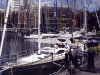
Middle
reaches
By
Hampton
Court Palace![]() London is loosing its grip on the river and narrow boats start to make
an appearance alongside the large sightseeing cruisers. Many of these
will
be travelling on the Thames and the Oxford canal, their narrow beam
making
them ideal for the smaller locks upstream. Often now one bank of the
river
will be lined with, sometimes expensive houses, although
fortunatly
it is rare for walkers to be excluded from both banks, although
sometimes
there is a feeling that owners do not really want a right of way
through
thier front gardens, in one a brass plaque reads "Right of way - No
stopping"
!
London is loosing its grip on the river and narrow boats start to make
an appearance alongside the large sightseeing cruisers. Many of these
will
be travelling on the Thames and the Oxford canal, their narrow beam
making
them ideal for the smaller locks upstream. Often now one bank of the
river
will be lined with, sometimes expensive houses, although
fortunatly
it is rare for walkers to be excluded from both banks, although
sometimes
there is a feeling that owners do not really want a right of way
through
thier front gardens, in one a brass plaque reads "Right of way - No
stopping"
!
Way up
stream
Beyond
Oxford,
with
its
college
boathouses the river moves into a private
land,
soon the locks are manually operated (from Kings
Lock![]() near the "Trout Inn" which is well worth a visit as is the thatched
"Perch"
800 years old and reputedly named "The Parrot" for the first hundred
until
the inevitable sad event took place, well thats what I heard...).
near the "Trout Inn" which is well worth a visit as is the thatched
"Perch"
800 years old and reputedly named "The Parrot" for the first hundred
until
the inevitable sad event took place, well thats what I heard...).
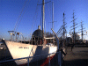
Bridges
become
few
and
are
inevitably accompanied by an Inn, in the case of Newbridge![]() by two, the Rose Revived, run by a major chain "Green King" thankfully
with accomodation and the other "The Maybush" on the other bank,
thankfully
with good homecooked food.
by two, the Rose Revived, run by a major chain "Green King" thankfully
with accomodation and the other "The Maybush" on the other bank,
thankfully
with good homecooked food.
This
general
pattern
repeats
itself
at the next bridge "Tadpole Bridge" with
its "Trout Inn"![]() .
We overheard a telephone conversation with the landlord "Yes sir, this
is the Trout Inn, are you sure you have the correct one........Yes, we
are by the Thames as are the other two......yes, and all three are by
bridges!"
.
We overheard a telephone conversation with the landlord "Yes sir, this
is the Trout Inn, are you sure you have the correct one........Yes, we
are by the Thames as are the other two......yes, and all three are by
bridges!"
At
Lechlade
we
meet
the
limit of navigation for all but small boats. There
are two bridges here, St Johns with its accompanying "Trout
Inn"![]() and Ha'penny bridge with its tollbooth.
and Ha'penny bridge with its tollbooth.
We
stayed
in
the
Market
Square at the "New Inn"![]() .
A coaching inn with its stables converted into extra rooms.
.
A coaching inn with its stables converted into extra rooms.
Cricklade
is
the
last
town
on the river, on our first visit we failed to engage
with
Cricklade, it seemed all pool tables and "Swindon troublemakers not
welcome
here". But second time around we struck lucky with "The
Old Bear"![]() ,
a locals pub with a room above the bar and three converted stables at
the
back, breakfast is at a communal farmhouse type table and although
there
is no food on Sunday (this is a proper drinking pub, not a semi
restaurant)
a decent Indian restaurant across the street will feed you.
,
a locals pub with a room above the bar and three converted stables at
the
back, breakfast is at a communal farmhouse type table and although
there
is no food on Sunday (this is a proper drinking pub, not a semi
restaurant)
a decent Indian restaurant across the street will feed you.
Beyond
Cricklade
the
river
starts
to become elusive, without river traffic the
need for a footpath has become less and our route, although usually
next
to water, is not always next to the river, which at times is now almost
fading away, especially in summer.
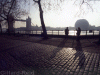
The
last
leg![]() is across meadows with the unmistakable dry bed on our right, only full
under very wet conditions.
is across meadows with the unmistakable dry bed on our right, only full
under very wet conditions.
1]
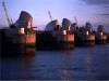
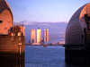
As of 2001 an extension downstream from the barrier, waymarked with a
Thames
barge logo, connects with "The London Loop" at Erith.The
QE2
bridge
beyond the extension![]()
The
River Thames
The
name
"Thames"
is
probably
abbreviated from "Themesis" (possibly
'Tam'
- "wide" and 'Isis' - "water"). Although it has been suggested that up
river it was called "Thames" and downriver "Plowonida" (which also
means
wide river from pre celtic "plew" and nejd") and that "Londinium"
derived
from "Plowonida".
However
it
got
its
name,
on your walk you will pass 45 locks, 58 islands
(usually
called "ait" or eyot") plus the Isle of Dogs, (not really an island)
and
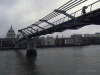
103 bridges of all ages, from the Millennium
bridge![]() and Hungerford
footbridges (2002)
and Hungerford
footbridges (2002)![]() to Abingdon Bridge (1416) and New Bridge
(14C)
to Abingdon Bridge (1416) and New Bridge
(14C)![]() .
In London there are also 16 tunnels, usually for the London
Underground,
one of which, Marc Brunel's Thames Tunnel,
dates
from
1843
.
In London there are also 16 tunnels, usually for the London
Underground,
one of which, Marc Brunel's Thames Tunnel,
dates
from
1843![]() .
Only one is a foot tunnel, at Greenwich,
dating
from 1902
.
Only one is a foot tunnel, at Greenwich,
dating
from 1902![]() .
.
The
Thames
has
not
always
been the same, half a million years ago it flowed
from Wales to Clacton and onward to become a tributary of the Rhine,
before
the North Sea existed. But the southward march of glaciers blocked its
path and diverted it southwards to its present position where it stayed
when the glaciers retreated.
In
more
recent
times
the
Thames formed a major highway between London and
Westminster, Hampton Court and Oxford, The Guild of Watermen being the
"black cabs" of their day. Today we are again starting to see our river
as an underused resource and river buses now operate to relieve
London's
choked roads. Later, during the days of the British Empire the Thames
was
at its centre with goods flowing in and out of the city docks, but post
the two great wars, business has moved downstream to deep water
harbours
and the old docks, heavily bombed during the second world war have now
almost entirely been regenerated as a second business district and
housing
for those that work in it. Freed of much of its industry, the (now
abolished)
GLC and TWA have cleaned up the river so it is now one of the cleanest,
if not the cleanest, to flow through a major city. When out taking
photos
in the early morning I have seen fisherman, with angler's rod or
otherwise,
catching fish ![]() in the shadow of Canada Tower.
in the shadow of Canada Tower. ![]()
Thames
photographs
Photo
thumbnails by location:-
(there
are
over
200
thumnails
so it might be worth making a cup of tea while
they
load, note that these links are not all to the top of pages, so it may
appear that nothing is loading at first)
Page1
Thames
Barrier to Greenwich
Greenwich
to Tower Bridge (from north bank)
Greenwich
to Tower Bridge (from south bank)
Tower
Bridge to the Houses of Parliament (from north bank)
Tower
Bridge to the Houses of Parliament (from south bank)
Page
2
Lambeth
to Hampton Court
Hampton
to Windsor
Windsor
to Goring and Streatley
Goring
and Streatley to Oxford
Oxford
to Source
Thumbnails
of
an
edited
selection
of the photographs can be found down the left
hand
edge of the pages.
Alternatively
you
can
view
that
selection starting from here.
(Just click on the image for the next one). To view all the
photos
sequentially click here
London walks
Long Distance footpaths