

OS Landrangers:-

*only small section of 174 that can be photocopied and attached to 175, or rely on guidebook maps.
 National
Trail Guide "The Thames Path" 2001
edition showing several material recent changes bringing several new
sections
of riverbank onto the route. Description plus extracts from OS maps at
1:25000 and 1:16000 scales. The larger scale is very useful for London,
where the extra detail is invaluable.
 Thames
path National
Trail Companion
Accomodation
and facilities along the path
![]()
![]()
 "Walks
Along the Thames Path"
25
Circular walks along the Thames from Thames Head to Greenwich
![]()
![]()
A map of the Thames from Tower Bridge to the source with useful insets of towns along the river. Although mainly aimed at the boat user, it gives much useful information, including campsites, pubs, water taps, toilets etc. 1:60000 (Does not show latest changes to path).
The Canals
While the
appropriate OS maps (1:50,000) are useful for getting to and from the
walks and some aspects of navigation and planning, a dedicated boaters
guide is very
useful for detailed information of which side the towpath is on
and names of locks etc. The Lea Navigation is the one area I have found
the 1" OS map unhelpful, the sheer complexity of water making it hard
to know where the path goes. Luckily signing on the ground is good
except at Three Mills.
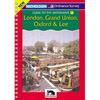
 Nicholson - Guide to the Waterways - London,
Grand Union, Oxford and Lee (and Stort)
Ring back guide book with
extracts from OS 2 inch to the mile maps with additional information
superimposed.

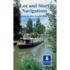
 GEOprojects map - Lee and Stort Navigations with the East
London ring
GEOprojects map - Lee and Stort Navigations with the East
London ringApprox. 1 inch to the mile map with large scale additional maps of complex areas

Walked it, now thinking of doing it by boat?
"River Thames A companion and Boating Guide" 190p
Full details of the river, each lock described in detail with diagrams including awkward currents etc, watermanship, planning a cruise, buying a boat and the history of the river. Lots of interesting b&w (often old) and colour photographs.
Incidentally, if you have fallen in love with the idea of owning a boat on the Thames, look into moorings before you even consider looking at boats - unless you decide on a towable boat.
"The
Inland Waterways Manual" Barrell 200p
Everything
you need to know about hiring or owning a boat on the inland waterways,
including the Thames.
Which
waterway? Which boat?
Nautical
terms
Handling
a boat
Locks,
bridges, tunnels
(did
you know to judge if you can clear a bridge? Set your eye alongside the
highest point of your boat and if you can see the underneath of the
bridge,
your OK)
Problems
and safety
Maintenance
Buying
a boat including trailer boating
The
Waterway system![]()
Previous page
Next page
 "The
Thames Path" - Cicerone - Hatts